Aerial 360


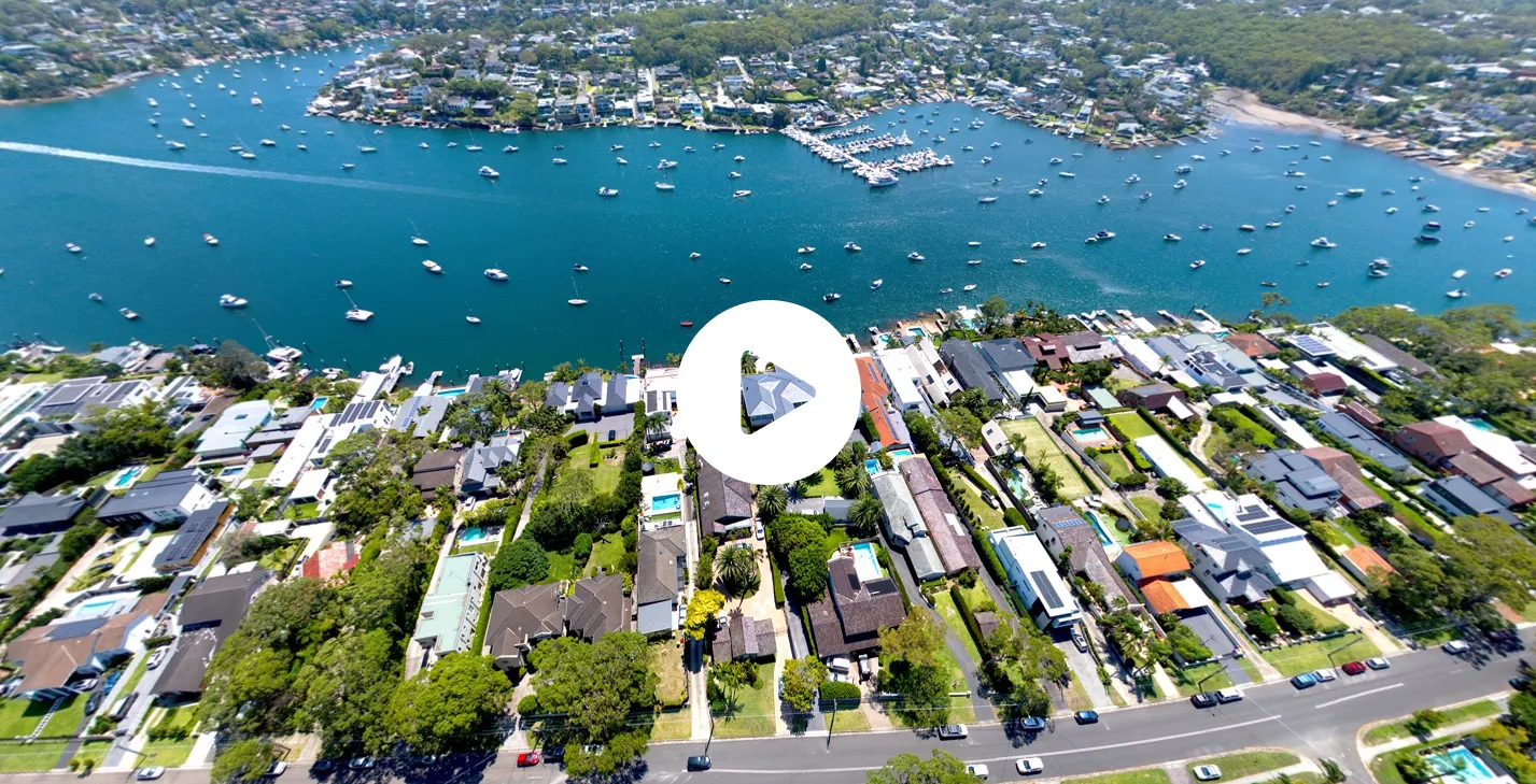
Aerial 360 drone panoramas from $240 + GST
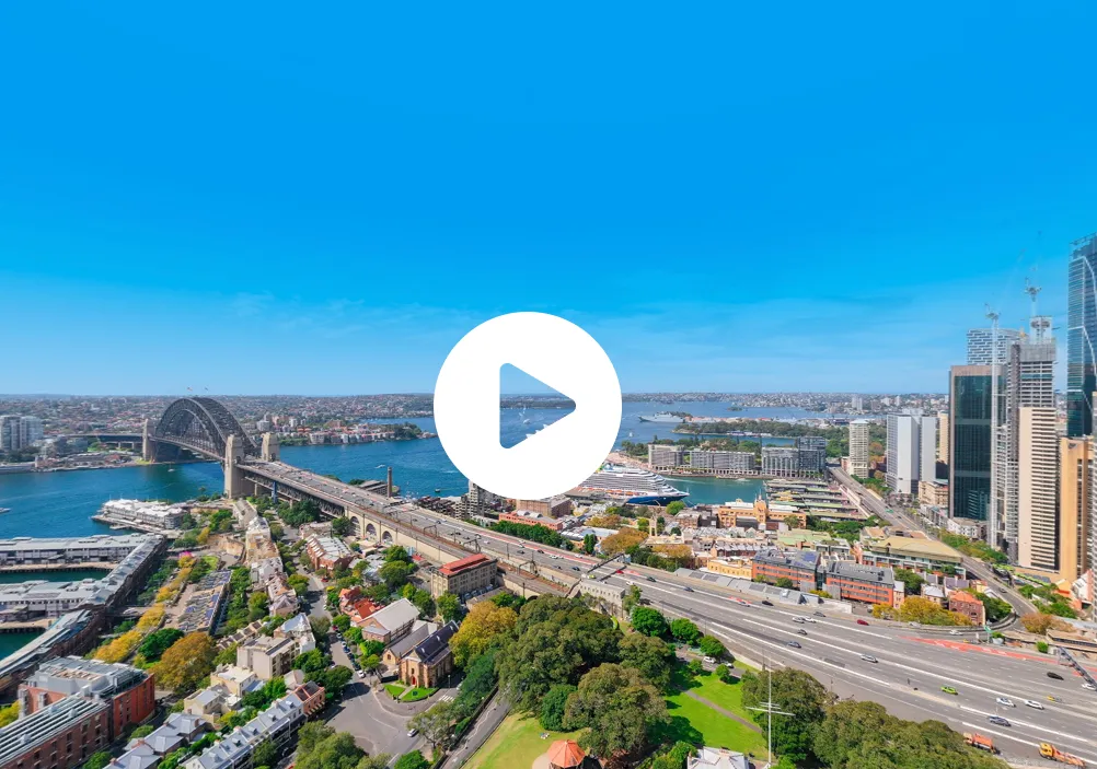
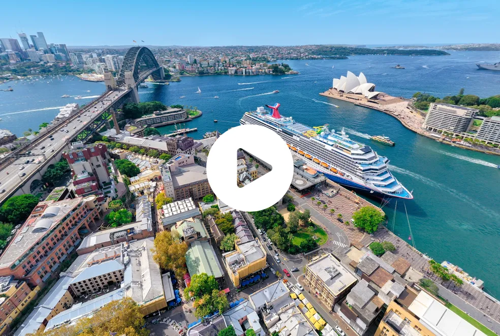
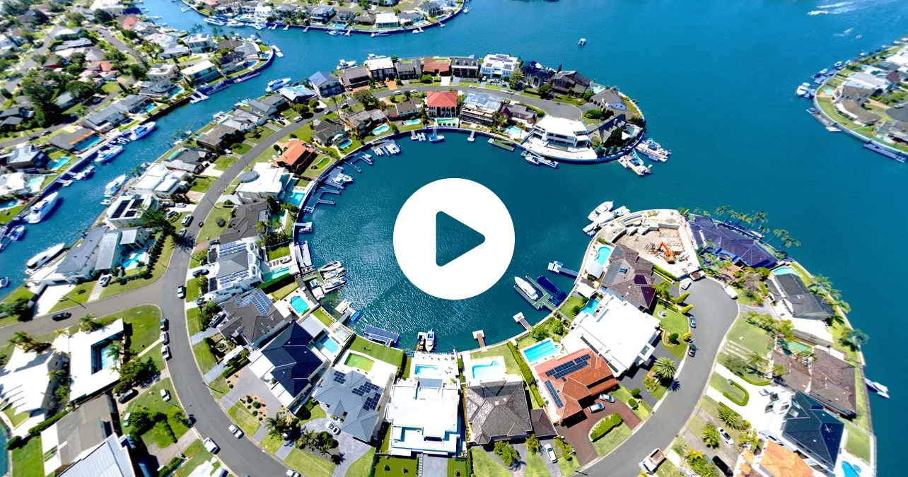
An Aerial 360 is an interactive panorama taken from above the property. Instead of a single fixed view, buyers can turn the image in any direction and look across the whole neighbourhood: the street, the water, the parks, the schools, the shops and the roads that lead to them. It answers the questions every buyer asks about a location before they decide to inspect.
Aerial 360 panorama
From $240 + GST
A full 360-degree view from above the property that buyers can explore in every direction.
Drone photos
From $180 + GST
Still aerial images for the listing gallery, brochures and signboards. See drone photography.
Photography package
From $280 + GST
8 professional photos, ready within 24 hours of the shoot. See photography.
Why location sells
Buyers pay for location as much as for the house itself, yet a standard listing can only describe it in words: close to the beach, walk to the station, near the best schools. An Aerial 360 shows it. Buyers can see exactly how far the property is from the water or the village, which way it faces, what surrounds it and what the outlook is like, all before they arrive. Buyers who inspect after exploring an Aerial 360 already understand the location, so they come ready to talk about the property.
Properties that suit Aerial 360
Waterfront and views
Harbour, beach, river and canal homes, where the outlook in every direction is the selling point.
Acreage and development
Large blocks, rural properties and development sites, where buyers need to understand the land and its surroundings.
Commercial and industrial
Office, retail and industrial assets, where access, transport, parking and neighbouring businesses matter to tenants and investors.
Aerial 360 or drone photos?
Drone photos give you fixed hero shots chosen to show the property at its best. An Aerial 360 gives buyers control, so they can look wherever they want. They work best together: stills in the listing gallery to stop the scroll, and an Aerial 360 for buyers who want to explore the neighbourhood before they inspect.
Captured by CASA-certified pilots
Every Aerial 360 is captured by a CASA-certified UberRE pilot, and UberRE holds a commercial licence to cover difficult projects and restricted sites. We fly across Sydney, Melbourne, Brisbane, the Gold Coast, the Sunshine Coast, Wollongong, the Central Coast, Newcastle and the Mid North Coast.
Aerial 360 FAQs
How much does an Aerial 360 cost?
UberRE Aerial 360 panoramas start from $240 + GST.
What is the difference between an Aerial 360 and a 3D tour?
An Aerial 360 is taken from the air and shows the property's location and surroundings. A Matterport 3D tour is captured on the ground and lets buyers walk through the inside of the home.
Can I add an Aerial 360 to a photography booking?
Yes. Aerial 360 panoramas can be booked on their own or added to a photography, drone or 3D tour order.
Where do you fly?
Across Sydney, Melbourne, Brisbane, the Gold Coast, the Sunshine Coast, Wollongong, the Central Coast, Newcastle and the Mid North Coast, including commercial and development sites.
How buyers use an Aerial 360
Buyers explore an Aerial 360 the way they would study a map, but with a real view instead of lines and labels. They check how far it is to the beach, the station or the village, whether the street is busy, what backs onto the property, how much green space is nearby and which way the home faces for sun and views. Interstate and overseas buyers use it to understand a suburb they have never visited. Local buyers use it to compare one street with the next. Either way, the questions that usually come up at the first inspection are answered before they arrive.
Planning your Aerial 360
Tell us what matters most about the location when you book, such as the water, a school, a park or a transport hub, and we'll make sure the panorama shows it clearly. Every Aerial 360 is captured when the conditions are right, with low wind and strong sunlight, so the view is bright and sharp in every direction. Pair the Aerial 360 with drone stills and ground photography for a complete set of marketing images from one booking.